By Laxmi Devi Jan 28, 2023
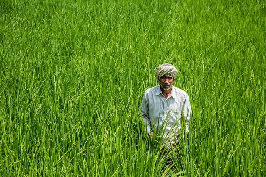
For Ramesh Gowda, a farmer in the southern province of Karnataka in India, acquiring and maintaining a small piece of land was not easy a few years back. He recalls how he struggled for a year to obtain a land title from the local record keepers.Computerisation seems to be bringing back a smile.
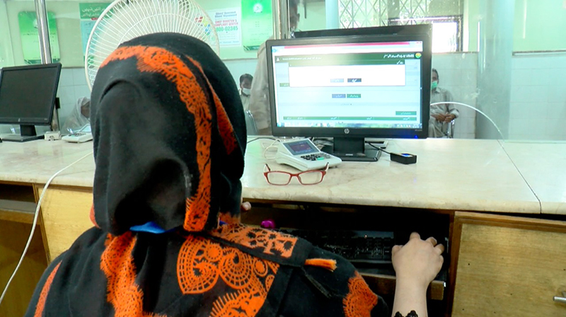
The computerised system has saved us from that hassle of endless visits to the revenue department, where finding relevant land ownership records used to be a nightmare. I came here today, and I got the needed old and current land records at the click of a button, 60-year-old Gowda said.
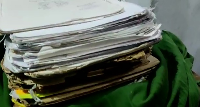
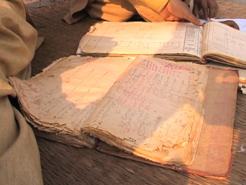
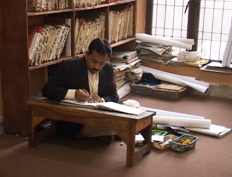
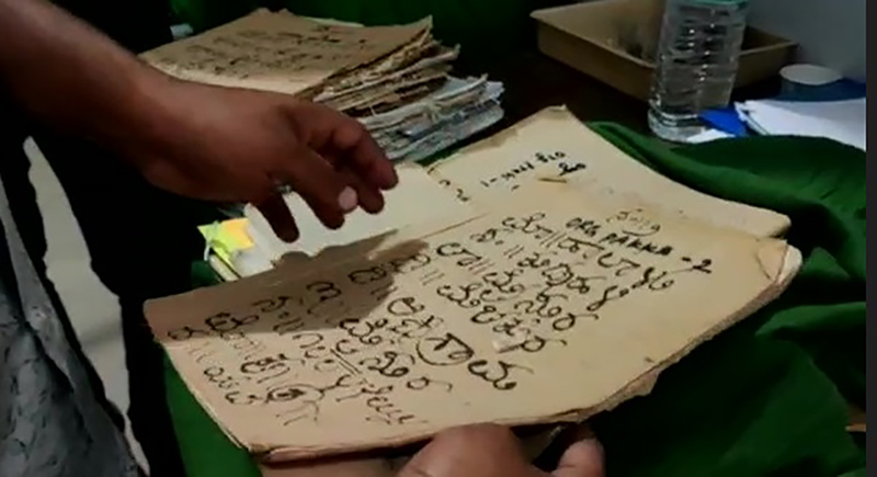
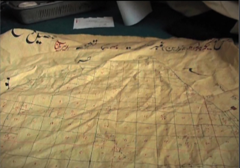
Traditionally, the land records were maintained initially on animal hide and cloth, and gradually on paper both in India and Pakistan. But with time, some historical records were destroyed by fire or natural disasters. The physical records available now are usually not easily accessible to the public as they are stored in a dusty record vault.
In the last three decades, India has made significant progress in digitisation of rural and urban land records. Pakistan, too, has made efforts in the Punjab province. Although the extent of computerisation across the two countries differs, results have begun to show on the ground.
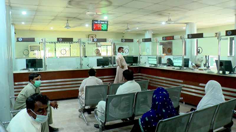
After uploading documents and online payment of the prescribed fee, a visit to the office of the sub-register is required for signatures, and the registration work is done with, said Sudhir Kumar, a farmer in the Indian state of Bihar.
Like Gowda and Kumar, millions of farmers in India benefit from the digital upgrade of farmland records in villages. They explain how data fed into computers has eradicated delays and reduced corruption, bribes and manipulation of records.
In India, the computerisation of land records has been underway since the 1980s, but in 2008 the earlier two schemes were merged into one as a centrally- sponsored programme called Digital India Land Record Modernisation Programme (DILRMP) under which 100 percent grant and technical help is being given to state governments to develop a pan-India land records information system.
As a result, India has been able to digitise 72 percent of 940 million agricultural land parcels so far under the DILRMP, said Sonmani Borah, Joint Secretary, Union Ministry of Rural Development.
Slow internet can be a challenge for users of digital records, but the Indian government is asking state governments to install local servers to reduce the problem.
Pakistans progress
Whereas in Pakistans Punjab province, the computerisation of land records formally kick-started in 2016 under the World Bank funded project called Land Records Management and Information System (LRMIS).
Under this project, 55 million rural agricultural land records have been computerised so far, said Captain (Retd) Ikram Ul Haq, Director General of Land Records, Pakistan.
About 25 million unique data have been embedded into these records. The unique data pertains to lands owned by a single owner or those farmers who own lands at different places, along with the list of 45 million tenant farmers.
Pakistani officials also have set up 145 land record centres. That apart, 145 land record centres have been set up at Patwari level, another 20 land record centres at Qanoon Goi level, besides 20 mobile land record centres.
In Pakistans Punjab province, the computerisation process entails scanning old property documents and creating a database, while field staff marks the land property. This data is now made available online to the users to check and review their land record details.
Going forward, specialised GIS teams would soon be hired for identification, marking and measurement of land parcels, Haq added.
The computerisation process in Punjab province is set to get a further boost with the launch of the Punjab Urban Land System Enhancement (PULSE), expected to start in 2023. PULSE will computerise the remaining 7 per cent of all records with the World Bank funding of USD 150 million.
Along with land, the property details of constructed plazas, buildings, shops, etc would be computerised by 2027 and a property certificate would be issued, said Captain Haq and noted that the PULSE would give property owners a sense of security, prevent land fraud and encourage investors.
In Khyber Pakhtun province of Pakistan, about 50 per cent of land records has been computerised since 2013 and this is a positive sign for the region which is vulnerable with property disputes over female inheritance, said Syed Zafar Ali Shah, a senior member in the Board of Revenue Khyber Pakhtunkhwa (KPK).
To resolve conflicts over female inheritance, including fake thumb scans, the administration has recruited twelve women patwaris, as an experiment, for the first time.
In the provinces of Sindh and Balochistan, the computerisation of land records was started a couple of years ago, but no tangible progress has since been made as land records continue to be maintained manually with all their shortcomings.
In Pakistans Punjab province, 93 percent of rural agricultural land parcels have been computerised under this project so far, while the rest is in the process, Haq added.
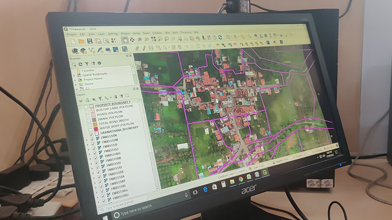
Georeferencing and drones
Data shared by Bohra shows India to be ahead of many countries on various parameters in land records digitisation process.
Until the end of September 2022, the computerisation of Record of Rights (RoR) or jamabandi (a legal document that details the land and who owns it) is completed in 65,669 villages of India, he said.
Over 70 percent of 16.66 lakh cadastral maps or basic survey documents of land called Tippan copy - have been completed, he said.
We are ahead of other countries in digitising land records and geo-referencing of cadastral maps. Even the U.S. does not have complete geo-referenced. In many places, they do the survey as and when required. But in India, we are aggressively promoting geo-referencing, Borah said.
Georeferencing is matching cadastral (paper) map coordinates like the plot size and longitudinal and latitudinal details, with satellite shots.
India still has thousands of unsurveyed villages, which are now being surveyed, using a combination of traditional chain and other methods such as the Electronic Total Station (ETS), Global Positioning System (GPS), high-resolution satellite imagery, aerial photography using drones.
Drone flying has been completed in 1.84 lakh villages, which is 49 percent of the total target of 3.73 lakh villages. Eighty-nine lakh property cards have been prepared for 58,400 villages so far, said an official in the Ministry of Panchayat Raj.
India has also taken an innovative step of issuing 14- digits alphanumeric unique IDs for each land parcel based on geo-reference coordinates. It is being implemented in 21 states and union territories so far and has proved helpful in ascertaining property and crop loss due to natural disasters.
The IDs contain ownership details of the plot and its size and help in checking land fraud, maintaining land records up-to-date, easier to share land record details with other departments and financial institutions besides helping deliver land record services to citizens through a single window.
With these unique codes, drones can be used for spraying pesticides on farmland, confirming crop losses and owner details of land destroyed due to floods, Bohra added.
India also is linking digital land records and the registration database with e-courts to settle land disputes early and banks to facilitate farmers loans. The plan to make available land records, especially the Record of Rights, in multiple languages is also underway.
(About the authors: Laxmi Devi is an assistant editor at The Press Trust of India in New Delhi, India; Shiraz Hasnat is the bureau chief for Hum News in Lahore, Pakistan; Naveen S. Garewal is the bureau chief of South India at Hyderabad for the Tribune Group of Newspapers; and Attiq Ahmad is bureau chief for Suno TV in Istanbul, Turkey. This report is part of a week-long cross-border reporting workshop held in Kathmandu, Nepal, organised by the US based East-West Center.)